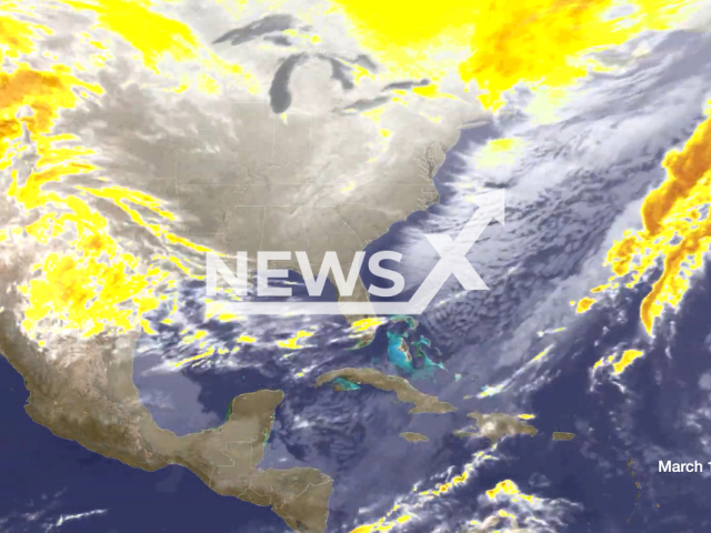
 The picture shows infrared imagery from NOAA's GOES-7 satellite capturing the storm's progression from the 10th of March to the 15th of March. Note: Picture is screenshot from a video. (NOAASatellites/Newsflash)
Copyrights: NOAASatellites/Newsflash
13 March 2023
THIS VIDEO IS OFFERED WITH A NON-EXCLUSIVE LICENCE FOR ALL NEWS MEDIA FORMATS AND ALL SOCIAL MEDIA. Details available on request: news@realpressglobal.com (start) The 1993 'Storm of the Century' brought an unprecedented amount of snowfall, with Mount LeConte, Tennessee, receiving nearly five feet of...